Training of Earth Observation Products to Support the Enhanced Water Security Investment Project and the Emergency Assistance for Rehabilitation and Reconstruction
17 June 2019 to 21 June 2019
Jakarta
Indonesia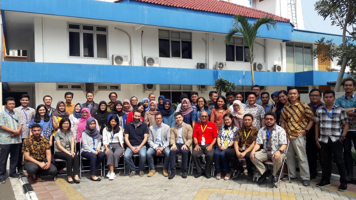
ADB, with support from the European Space Agency and in cooperation with the Ministry of Public Works and Housing of the Republic of Indonesia, conducted a training on 17-21 June in Jakarta on the use of high-technology innovation to support development projects. Hosted by the Indonesia's National Institute of Aeronautics and Space, the training brought together about 70 government officials to learn ways to utilize earth observation products to support the preparation and implementation of a proposed ADB project for enhanced water security investment, as well as in relation to the government's emergency rehabilitation and reconstruction efforts in Central Sulawesi province.
Program and Learning Materials:
| Date | Session / Activity | Presentation Material | Speaker(s) |
|---|---|---|---|
| 17 Jun 2019 | Opening | Opening remarks | Edy Juharsyah, Ministry of Public Works and Public Housing |
| 17 Jun 2019 | Opening | Introduction | Paolo Manunta, ADB |
| 17 Jun 2019 | Opening | Keynote speech | Rokhis Khomarudin, National Aeronautics and Space Agency |
| 17 Jun 2019 | Session 1 |
Introduction of Geoinformational support for Integrated River Basins Management - Geo4IRBM project Identification and documentation of ADB requirements; Area of interest Geoinformational products and services scope |
Przemysław Turos |
| 17 Jun 2019 | Session 1 |
Operational applications of Geo4IRBM products in ADB practice Introduction of applications of Sediment Yield maps in Raw Water supply subprojects; Introduction of applications of Water Extent, Subsidence and Land... |
Eric Quincieu |
| 17 Jun 2019 | Session 1 |
Copernicus - Earth Observation Program Copernicus space segment (operational and planned satellites of Sentinel constellation; Elements of ground segment (examples of Collaborative Ground Segments... |
Przemysław Turos |
| 17 Jun 2019 | Session 2: Geo4IRBM |
Land cover mapping; Cropping intensity mapping; Surface water and surface deformations monitoring; Surface potential erosion and sediment yield modelling; Coastline and surface water coverage mapping; Ecosystems/biodiversity mapping and monitoring Products and services description, means of data and information |
Przemysław Turos, Rafal Dabrowski, Dariusz Ziółkowski |
| Date | Session / Activity | Presentation Material | Speaker(s) |
|---|---|---|---|
| 18 Jun 2019 | Session 3: Geo4IRBM | Land Cover Mapping | Przemyslaw Turos |
| 18 Jun 2019 | Session 3: Geo4IRBM | Land Cover Changes Mapping | R. Dabrowski |
| 18 Jun 2019 | Session 3: Geo4IRBM | Cropping Intensity Mapping | Przemyslaw Turos |
| 18 Jun 2019 | Session 4: Geo4IRBM | Surface Water Monitoring | Przemyslaw Turos |
| 18 Jun 2019 | Session 4: Geo4IRBM | Surface Deformations Monitoring | D. Ziolkowski |
| 18 Jun 2019 | Session 4: Geo4IRBM | Environmental analysis | Przemyslaw Turos |
| Date | Session / Activity | Presentation Material | Speaker(s) |
|---|---|---|---|
| 19 Jun 2019 | Session 5: EO4SD | Introduction EO4SD in Support to Disaster Risk Reduction | Paolo Manunta, Alberto Lorenzo Alonso |
| 19 Jun 2019 | Session 5: EO4SD |
Earth Observation for Sustainable Development's Disaster Risk Reduction (EO4SD DRR) in support to risk and recovery in Central Sulawesi General presentation of EO4SD DRR Support to Sulawesi recovery; General presentation of the EO4SD DRR project. How the project was “activated” for supporting... |
Alberto Lorenzo Alonso |
| 19 Jun 2019 | Session 6: Synthetic Aperture Radar (SAR) |
Introduction to theory of Synthetic Aperture Radar (SAR) for ground motion monitoring Introduction to SAR, SAR Interferometry (InSAR), and DInSAR; Working principles, applicability requirements, and main error sources of SAR techniques ... |
Vicenzo Massimi |
| 19 Jun 2019 | Session 6: Synthetic Aperture Radar (SAR) | Engineering applications of Multi-Temporal DInSaR (MT-DInSAR) through the Rheticus® platform | Vicenzo Massimi |
| 19 Jun 2019 | Session 6: Synthetic Aperture Radar (SAR) |
Analysis of the PSI results on Central Sulawesi; Added value to the PSI result Rheticus® Displacement service presentation; Presentation and discussion of the results of the MT-DInSAR data processing (PS/DS map), ex-ante and ex-post... |
Vicenzo Massimi |
| Date | Session / Activity | Presentation Material | Speaker(s) |
|---|---|---|---|
| 20 Jun 2019 | Session 7 |
The Copernicus Sentinel & European Space Agency's Earth Observation programs Sentinel missions’ overview and status; Sentinel operational products and data access; ESA heritage SAR missions and new mission concepts; Scientific ... |
Michael Foumelis |
| 20 Jun 2019 | Session 7 |
European Space Agency's Geohazard Exploitation Platform (GEP) Background; Thematic Apps and Services; Community platform and e-collaboration; The Early Adopters programme |
Michael Foumelis |
| 20 Jun 2019 | Session 8 | Theoretical Background on SAR, InSAR and Optical Remote sensing | Michail Foumelis |
| 20 Jun 2019 | Session 8 | Building Experience with GEP services | Michail Foumelis |
| Date | Session / Activity | Presentation Material | Speaker(s) |
|---|---|---|---|
| 21 Jun 2019 | Session 9 | Presentation of the flood susceptibility: Automatic extraction of flood events using satellite imagery; Geomorphic approach for flood hazard modelling | Alberto Lorenzo Alonso |
| 21 Jun 2019 | Session 9 | Exposure mapping: presentation of the Land Use Land Cover product: Central Sulawesi Province | Alberto Lorenzo Alonso |
| 21 Jun 2019 | Session 10 | Risk mapping; End-to-end services; Products in a user context | Alberto Lorenzo Alonso |
| 21 Jun 2019 | Session 10 |
Potential further cooperation: Indonesia, ADB, ESA Potential futher cooperation among Government of Indonesia, ADB, and ESA |
Alberto Lorenzo Alonso |